Footpaths & Walks
Around Our Ancient Cotswold Village
the brailes footpath group Welcomes walkers
Did You Know? The parish of Brailes has 24.6 miles of footpaths and bridleways
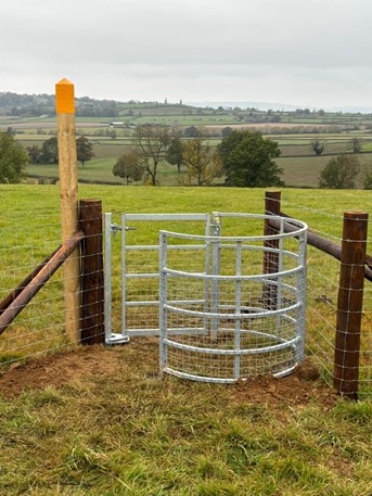
Brailes enjoys an extensive network of footpaths, paths, and bridleways, which link the village to other villages as far as Tysoe to the north, Shipston to the west, and Long Compton to the south. These pathways were in many cases the original roads connecting scattered rural communities for hundreds of years. Warwickshire footpaths near Shipston-on-Stour begin with SS. For instance SS71 links Lower Brailes via Sutton-under-Brailes to Cherington. Many stiles have dog gates fitted – a sort of guillotine gate.
Use us!
Routes 50, 52, & 53 began from the need to get across the village quickly on foot. Nicer than driving!
Pet Control
When walking your pet please keep it on a leash, and clean up any poo.
Leave it as you found it
Close gates, take litter home etc. We can all respect the Brailes Footpath Group’s work to maintain the paths & gates.
Join In!
If you find any paths, gates, dog gates, stiles or anything that is in need of repair or attention please email Brailes Footpath Group.
brailes footpath Map

Walks Around Brailes
| Route No. | Description | Link | Directions available? |
| 1 | Circular walk to Sutton looking out over the Feldon Valley and returning alongside Sutton Brook. | https://out.ac/gZtWH | Y |
| 2 | Castle Hill & 99 steps from The Gate Inn | https://out.ac/gZtVk | N |
| 3 | Upper Brailes short walk | https://out.ac/gZtVn | N |
| 4 | Circular walk along edges of the Feldon Valley to Cherington, Stourton & Sutton. | https://out.ac/gZtVp | Y |
| 5 | Circumnavigate Brailes Hill. Views across the adjacent valleys from the public footpaths that get closest to the top of Warwickshire’s 2nd highest peak. | https://out.ac/gZtVr | Y |
| 6 | A longer walk from Brailes to Whichford & Whichford woods via Cherington. Something to see at any time of year but a wonderful display of bluebells in spring in the woods. | https://out.ac/gZtVt | Y |
| 7 | Gentle walk across farmland to the east of Brailes to Winderton, taking in 3 historic churches. | https://out.ac/gZtVv | Y |
Route 1 – Sutton Circular
Walk to Sutton looking out over the Feldon Valley and returning alongside Sutton Brook
Link: https://out.ac/gZtWH
Directions Available?: YES
Route 2 – Castle Hill & 99 steps from The Gate Inn
Link: https://out.ac/gZtVk
Directions Available?: NO
Route 4 – Circular Walk to Cherington
Along the edges of the Feldon Valley to Cherington, Stourton & Sutton
Link: https://out.ac/gZtVp
Directions Available?: YES
Route 5 – Circumnavigate Brailes Hill
Views across the adjacent valleys from the public footpaths that get closest to the top of Warwickshire’s 2nd highest peak
Link: https://out.ac/gZtVr
Directions Available?: YES
Route 6 – Long walk Brailes to Whichford Via Cherington
Something to see at any time of year but a wonderful display of bluebells in spring in the woods
Link: https://out.ac/gZtVt
Directions Available?: YES
Route 7 – Gentle walk to Winderton
Stroll across farmland to the east of Brailes to Winderton, taking in 3 historic churches
Link: https://out.ac/gZtVv
Directions Available?: YES
Castle Hill-Iron Bridge Quick Circular
1. Right out of car park up Castle Hill Lane for 300m, take gate on left SS54
and follow up over Castle Hill.
2. Continue path through alley to Castle Hill road,
left down hill toward Junction with B4035.
3. Left along main road for 200m (be careful here) just before layby on left take wooden bridge SS57a.
4. Path follows bottom of tree line/edge of field. After 500m take SS58 up through Ashen Coppice, straight on toward Gillett’s Hill.
5. Where footpath splits 4 ways take 2nd from right to Iron Bridge SS58a.
6. At main road cross and continue on SS53 that delivers you back to the Village Hall.

MORE LINKS to Cotswold walks, happy walking!
Brailes Footpath Group
If you find any paths, gates, dog gates, stiles or anything that is in need of repair or attention please let us know by emailing:
brailesfootpathgroup @ gmail.com
Ideally please include:
– A description of the item in need of attention and/or photograph.
– The path number or rough location.